September-October 2026 / HIKING
It’s only a 1.8-mile hike up to Owl’s Head to get this view of Kettle Pond and Groton State Forest. Adobe Stock
20 Favorite Foliage Hikes
Follow Vermont’s Peak Foliage from North to South and See How Many of These Hikes You Can Tick Off
Fall starts with a change in the light. Each year, it catches us by surprise, as though the earth was being catapulted into the heart of winter. The maple trees notice it first. Bright green leaves burn to orange at the tips. The colors start to change along the ridgelines and wash down the mountainsides like wildfire, bursting with promise: snow is almost here. By late September, you can hike up any ski trail and find spectacular views – and good ski glades make for good foliage. But if you want to find the best of Vermont’s reds and purples, look for a hike that starts low enough to take you through a hardwood forest (the more open, the more reds and oranges you’re likely to see) and ends with a broad vista.
Dr. Abby van den Berg, a research professor at Future Generations University in West Virginia (formerly with University of Vermont), has spent the last 23 years studying the biochemical mechanisms by which trees such as birch, ash and maples produce fall color.
Native species such as the American beech, paper birch, gray and yellow birch produce brilliant yellow and orange leaves. Others, among them the sugar maple, also produce brilliant reds. “We still don’t fully understand why trees produce these red pigments, but we know they tend to appear in places where the leaves are directly affected by sunlight,” Abby says. For example, a tree standing on its own will have leaves that are red or orange toward the outer reaches of its foliage, with a swath of yellow close to the trunk.
“Often, stepping onto the trail in that northern hardwood forest, you’re in an envelope of yellow,” states Abby. “Even if you’re hiking through a stand of maples, you may only see red leaves at your feet. But then, you climb higher and if you look back at the ridge or hillside you just climbed, you’ll see those signature fiery reds.”
“Look for a landscape that has a lot of dark evergreens for contrast,” Abby continued. “And don’t be afraid of a cloudy day. Sometimes low-hanging clouds bring the best light for those richer hues.” Unlike the yellow and orange pigments, which are always present in a leaf, the reds are made new in fall, even as the leaf nears the end of its life – the last gasp of summer. “What we’re seeing are new pigments being formed in a dying organ at the time of its death,” Abby concludes.
Or, as a skier might see it, the promise of what is about to begin so be ready to come into snow or ice near the summits, especially on peaks such as Mount Mansfield or Camel’s Hump. Also, keep in mind that as you climb in altitude, the foliage will change and what might be a gorgeous foliage hike in mid-September will be over by mid-October. One way to extend foliage season is to head to southern Vermont later in the season.
Here, north to south are some of Vermont Sports staff’s (current and past) favorite foliage hikes. Note that we left out the two most popular, Mount Mansfield and Camel’s Hump, in favor of less-trafficked and lesser-known options. –Abagael Giles
Hike Difficulty – We’ve rated these routes based on elevation gain, trail condition, and distance. Keep in mind that these ratings are approximate and geared toward an above-average fitness level so don’t take on too much. Easy (*), Moderate (**), Difficult (***), Extreme (****).
Lake Willoughby’s steep hillsides and cliffs make for stunning foliage. Hike up Mount Pisgah for a view down the whole lake. S. Bagcilar
NORTHERN VERMONT
Kingdom Heritage Trail, Canaan (** - ****) – In 2013, the Kingdom Heritage Trail was established, linking together trails to form a network of over 20 miles of hiking trail on former timber land. You can do the full 20 miles, but you don’t have to. For a taste of the area and stunning views of the Nulhegan Basin, take the Bluff Mountain Community Trail from Island Pond to Lookout Junction and the Lookout Trail. This trail is a moderate 2.6-mile hike that lollipops its way through the Brighton State Forest with a variety of hardwood and softwood trees. The Upper Lookout Trail to the summit is steep and has metal handholds so be prepared. It also connects to the Gore Mountain Trail and Middle Ridge trails, which offer limited views. The trail system is managed by the Green Mountain Club and Northwoods Stewardship Center.
Getting there: From Island Pond head north n VT 105 for 0.3 miles. Turn left onto Curran Avenue and continue for 0.2 miles. Turn right onto Mountain Road. Trail: Bluff Mountain Community Trail, 2.6 miles. Map: Pick up trail maps at Northwoods Stewardship Center or at Green Mountain Club. Difficulty: Modoerate.
Mount Pisgah, Westmore (**) – Lake Willoughby, one of Vermont’s deepest lakes, is surrounded by steep mountains and those slopes erupt with color come fall. The hike up Mount Pisgah ends with views out across the lake’s clear, deep waters all the way to the slopes of Burke Mountain and Jay Peak. From a parking area near the southern end of Lake Willoughby on Route 5A, the trail starts on old logging roads and climbs ever upward through mixed hardwood forests to a series of footpaths that lead to two vistas: one facing north and the other facing west. Look out at the cliffs of Mount Hor, which rises a steep 1,400 feet from the water across the lake and look north for views of Lake Memphremagog, Owl’s Head and Bear Mountain. Trail: The North Trail (4.4 miles round-trip). Map: GMC Northeast Kingdom. Difficulty: Moderate.
Belvidere Mountain, Eden (**) – If you’re looking to beat the crowds, this is a great hike with a fire tower as a prize when you reach the summit. From the parking lot on Route 118, head north on the Long Trail through deciduous forest, crossing Frying Pan Brook. Climb steeply through maple and beech until you reach the saddle and a 0.2-mile spur to the summit (3,340 feet). There, you will have stunning views to the east and if you climb the 50-foot fire tower, which was restored in the 1990s, a 360-degree view of the northern Green Mountains and New Hampshire’s Mount Washington. You will also see the nearby Cold Hollow Mountains, which are covered mostly in deciduous trees and usually offer up spectacular foliage. For the adventurous, try a challenging 7.9-mile loop, connecting the Frank Post Trail, the Long Trail and the Forester’s Trail. Stop for lunch at Tillotson Camp, a cozy four-sided GMC shelter with a view that overlooks a pond along the way. Trail: The Long Trail (5.8 miles round-trip). Map: GMC Long Trail. Difficulty: Moderate.
Owl’s Head, Peacham (*) – One of the most photographed scenes in Vermont – rolling hills, vibrant foliage and ponds tucked in the folds of ancient granite – is just a short hike. The last part is up stone steps built by the Civilian Conservation Corps in the 1930s. The flat, rocky outcrop that delivers these views is just a 3.6-mile round-trip hike. At the top, the vast expanse of the New Discovery State Park, Groton State Forest, Lake Groton and Kettle Pond unfold below. While this trail is often popular on weekends, go during the week and you could have it to yourself. There are many places to camp, including paddle-to sites on Kettle Pond. Getting there: from Route 232 take the New Discovery State Park road leading to Osmore Pond and the parking lot is off the road. There is a second lot farther up if that is full. Trail: Owl’s Head, 3.6 miles. Map: Groton State Forest. Difficulty: Easy.
Smugglers’ Notch-Sterling Pond, Jeffersonville (**) – Smugglers’ Notch, the dramatic rift through some of the tallest peaks along the Green Mountain spine, is a leaf peeper’s dream. As early as mid-September the steep slopes covered in birch and maple are awash in orange and yellow. While the hiking and even the ski trails leading to the summit of Mount Mansfield are packed at this time of year, you can find fewer crowds and even better leaf peeping if you head up the Spruce Peak side of Route 108. To get to Sterling Pond, hike up and out of the Notch, climbing steeply through glades above the Spruce Peak base area. On the Long Trail, head up past Elephant’s Head Buttress, a 2,500-foot granite cliff that is a mecca for rock climbers across the state. Be sure to stop at the top of the cliff to take in the view, which reaches all the way down the Notch to the slopes of Stowe and looks up at the Chin of Mount Mansfield. Once at the pond, you’ll find a shelter, the occasional loon, and a 1.4-mile trail around the pond. If you spend the night, hike a little farther to the top of Madonna Peak and take in sweeping fall foliage views from the top of Smugglers’ Notch Resort over the Lamoille Valley and north to Jay Peak, with views of the Adirondacks in the distance. Trail: Sterling Pond Trail (2.2 miles round-trip) or The Long Trail (6.8 miles round-trip). Map: GMC Mt. Mansfield and Worcester Range. Difficulty: Moderate.
Hunger Mountain, Waterbury Center (***) – While everyone wants to climb Mount Mansfield, Vermont’s highest peak, locals often head across the valley to the Worcester Range to hike. From the ridge of the Worcester Range, you can see Mount Mansfield, Camel’s Hump, and if it’s clear, all the way south to Killington. From the parking area on Sweet Farm Road, follow a blue-blazed trail that climbs through open maple and beech forests and up the western flank of Mount Hunger (3,586 feet). If you time it right, expect many orange and red hues on this hike. The trail is steep and rocky, but the views from the bald summit, cleared by a long-ago forest fire, feature a 360-degree foliage extravaganza. All told, you can spot at least five ski areas from this summit, including Killington on a sunny day. For added challenge and views, hike three miles north across the ridge to Hogback Mountain and descend via the Skyline Trail (one-mile), to a second vista at Stowe Pinnacle. Descend for 1.4 miles from there to the Stowe Pinnacle Trailhead, through beech and maple forest. Plan to shuttle a car. Trail: The Waterbury Trail (4.2 miles round-trip); Map: GMC Mt. Mansfield and Worcester Range. Difficulty: Difficult.
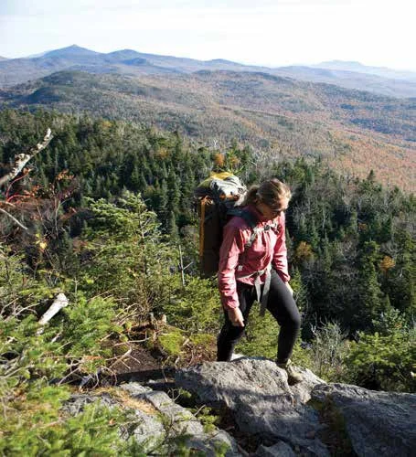
Emily Johnson backpacks the Monroe Skyline in early fall. Brian Mohr/EmberPhoto
CENTRAL VERMONT
Monroe Skyline, Waitsfield (***) – The Monroe Skyline separates the Mad River Valley from the Champlain Valley and when you summit one of the peaks along the way you will be treated to vistas of color and views west to the Adirondacks and Lake Champlain. If you can do this as a one-way hike, leave a car at Sugarbush and shuttle to the parking area at the top of Appalachian Gap on Route 17 (adding 3.1 miles to the trip) or ride the Single Chair from the base of Mad River Glen to the Stark’s Nest warming hut. The Long Trail goes from General Stark Mountain (3,662 feet), past Glen Ellen Shelter, to Mount Ellen (4,083 feet), the top of Sugarbush North. The third highest peak in Vermont, Mount Ellen can have magnificent views of fiery foliage on Camel’s Hump, the Worcester Range and Mount Mansfield. After two more craggy peaks (among them Castlerock Peak, 3,812 feet) with stunning views of the Mad River valley and Sugarbush’s famously endless yellow birch and sugar maple glades, descend to Lincoln Peak (3,975 feet) and hike down via the Jester Trail, or download on the Super Bravo lift to Sugarbush’s Lincoln Peak courtyard. Trails: The Long Trail (5.8 miles one-way). Map: GMC Camel’s Hump and Monroe Skyline. Difficulty: Difficult.
Battell Trail To Mount Abraham, Lincoln (***) – If you want a workout that will have you gasping at the views as well as catching your breath, take the Battell trail up to the Long Trail and the Battell Shelter. The route then follows the Long Trail north up steep grades of exposed bedrock before reaching more open views at the summit. After chilly weather, watch for icy patches on the steeper ledges just below the summit. Looking north, you can see Mount Mansfield, Mount Ellen and Camel’s Hump. To the south are Mount Grant, the Breadloaf Wilderness and even further south, Killington. The summit of Sugarbush South (Lincoln Peak) is just a half-mile to the east along the Long Trail. Getting there: From Lincoln, travel north on Quaker Street. Turn right at Alder Hill Road and continue onto US Forest Road 350. After two miles, parking is on the right. An alternative route is to go to the top of Lincoln Gap, park and take the Long Trail for two miles to the summit; it’s slightly shorter and less steep. Trail: Mount Abraham via the Battell Trail is a 5.8-mile round-trip but with a 2,500-foot elevation gain. Map: GMC Long Trail. Difficulty: Difficult.
Snake Mountain, Addison/Weybridge (**) – It’s a shame that someone changed the name of Grand View Mountain, as the hill that rises 1,287 feet from the farm fields of Addison County was once called, back to “Snake,” its original moniker. “Grand View” was the name Jonas Smith gave to a hotel he built on the summit in 1870. For marketing purposes, he changed the name of the mountain from Snake, in hopes of luring stagecoaches up the long driveway.
No matter what the name, there are still grand views at the top, west to Lake Champlain and east to the Greens, as well as a small cranberry bog. It’s a relatively easy 5.6-mile round trip hike from the parking area at Snake Mountain Road, though at times the trail is difficult to follow. In the fall, watch for migrating snow geese that often congregate just to the west in the Dead Creek Wildlife Refuge. Trail: Snake Mountain, Wilmarth Woods, 5.6 miles. Map: Snake Mountain Wildlife Management Area (VT Dept of Fish & Wildlife). Difficulty: Easy to moderate.
Mount Moosalamoo, Salisbury (**) – A classic hike with views of the Champlain Valley and Lake Dunmore, the trails around Mount Moosalamoo in the Moosalamoo National Recreation Area can make for an exciting day hike or an overnight trip. For the most scenic way to the summit, start at the Silver Lake/Falls of Lana trailhead parking lot just 1/8 mile south of the Branbury State Park entrance. The trail passes falls that plunge 40 feet or more before it crosses the north branch of Voter Brook and climbs via the Aunt Jenny Trail to the Oak Ridge Trail at 2.5 miles, a gain of 1,530 feet. The summit of Mount Moosalamoo is 0.4 miles farther on the Oak Ridge tTrail, but don’t rush up. The Aunt Jenny trail goes past Rattlesnake Cliffs with spectacular views of beautiful Lake Dunmore, Fern Lake and Silver Lake, as well as the Champlain Valley, Adirondacks, and peaks to the south. Other hikes, or mountain biking, along Chandler Ridge and camping at Silver Lake’s designated sites or the Moosalamoo campground can make this area good for multiple day excursions. Trail: Aunt Jenny to Oak Ridge, 5.8 miles. Map: Moosalamoo Association. Difficulty: Moderate.
Braintree Mountain, Braintree (**) – Cutting between Randolph and Rochester, the Braintree Range has four peaks: Round Top, Twin Peaks, Skidoo, and Braintree. The last tops out at 3,030 feet (hence the nickname, 30-30). If you’re looking for big views, great foliage and few crowds, Braintree may be the answer. The Ridgeline Outdoor Collective has cleared and mapped many trails in this area and there’s a kiosk and trailhead off Riford Road. From the trailhead, take the Haul Road up to the Bell Gates cabin (a winter warming hut for backcountry skiers), and in winter there’s a snowmobile trail up to the summit. Trail: Haul Road to summit trails, five miles. Map: Head to The Gear Shop in Randolph to pick up one of the Ridgeline Outdoor Collective maps of the area. Difficulty: Moderate.
Deer Leap, Mendon (*) – This is an easy day hike that includes portions of the Long and Appalachian trails, as well as a side trail that leads to stunning views of Pico Mountain from the Deer Leap Cliffs. The cliffs are a popular rock climbing area as well. The hike starts on the north side of Route 4 in Mendon and follows the blue-blazed Sherburne Pass trail until a junction at 0.5 miles. Continue on the Appalachian Trail until another junction for the Deer Leap trail is just a few steps further, which will bring you to the cliffs. Trail: Deer Leap Overlook. Length: two miles. Map: Green Mountain National Forest. Difficulty: Easy to moderate.
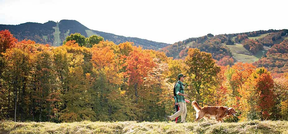
The Killington Peak to Pico hike delivers foliage at every elevation. To make it easier, take the gondola to the summit and hike from there. Chandler Burgess
Killington-Pico Link, Killington (**) – At 4,235 feet, the second tallest mountain in Vermont features sweeping views north to Mount Mansfield and south to Ascutney, Okemo and Stratton mountains. Start the day with a comfortable ride up Killington’s K1 gondola to the summit. From there, hike north on the Long Trail through boreal alpine forests, with sporadic views through the krummholz of lower foliage. After hiking over Snowden Peak (3,592 feet) and Ram’s Head (3,600 feet), you’ll head right at Jungle Junction, past Pico Camp to the summit of Pico Mountain (3,957 feet) for a beautiful view. Retrace your steps to Killington and take the gondola to the main base area. While it’s a seven-mile drive from Killington to Pico, the hike is a short 2.75 miles. Trail: Long Trail (5.4 miles round-trip). Map: GMC Killington Area with Ascutney and Okemo. Difficulty: Easy to moderate.
SOUTHERN VERMONT
White Rocks Cliffs Trail, Wallingford (**) – While the Moosalamoo National Recreation Area is better known, Vermont’s other National Recreation Area, the Robert T. Stafford White Rocks National Recreation Area, spans 22,6524 acres and includes an overlapping section of the Long Trail and Appalachian Trail. But it’s a side trail to the AT, the White Rocks Cliffs Trail, that has the big views. The quartzite cliffs that give the trail their name look west to the Taconics and Adirondacks. The trail begins at the White Rocks picnic area on the Keewaydin Trail, passes Bully Brook, before joining the trail to the cliffs (which are visible from Route 7). For those who want a taste of winter, the White Rocks Ice Beds trail leaves from the same parking area and is a short (0.4-mile) hike to a pile of boulders which cache pockets of ice that can last late into the summer. Trail: White Rocks Cliffs Trail, 3.2 miles. Map: Green Mountain National Forest/White Rocks Cliffs Trail. Difficulty: Moderate.
Mount Ascutney via Weathersfield Trail, Windsor (*) – The Weathersfield Trail climbs through Ascutney State Park past waterfalls under hardwood canopy, passing scenic outlooks and unique geological features. At the summit of this monadnock, the watchtower rewards hikers with views of New Hampshire’s White Mountains and Berkshires in Massachusetts. To get to the trailhead, take Exit 8 off I-91 to Route 131 west. Drive 3.3 miles to Cascade Falls Road and turn right. Bear left at the fork and continue to a right turn, 0.3 miles later. Drive up a short, steep hill to the parking lot and the Ascutney State Park info board. Trail: Weathersfield Trail, 5.7 miles; Map: Mount Ascutney State Park. Difficulty: Moderate.
Bromley Mountain, Winhall (***) – Southern Vermont’s stretch of Green Mountain National Forest has vast tracts of undeveloped land that the Long Trail traverses. But often there are few views, until you come to the peaks of ski mountains, such as Bromley. To get to Bromley’s summit views, follow the white-blazed trail south from the trailhead on Route 11 that heads along Bromley Brook, through mixed hardwood forests that should yield great yellow color with red and orange underfoot. The trail climbs steeply after 1.6 miles and at 2.3 miles, you’ll pass a spur for the Green Mountain Club’s Bromley Shelter. The trail eventually opens onto Bromley’s Run Around ski trail. Follow it to the summit for 360-degree views with Magic Mountain to the east, Stratton to the south, Killington to the north, and Mount Equinox to the west. The Bromley Ski Patrol hut is open to hikers during the fall and summer. Trail: Long Trail (5.4 miles round-trip) Map: GMC Manchester Area with Stratton and Bromley. Difficulty: Moderate.
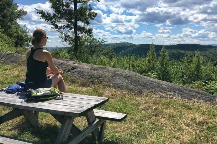
Windmill Ridge may not be as tall or steep as many, but it offers great trail running and open views from multiple spots. Ben Kimball
Windmill Ridge, Athens (***) – There are not too many trails in Vermont where you can trail run along a ridgeline without facing steep ups and downs. Thanks to the Windmill Hill Pinnacle Association, you can run or hike from Grafton to Putney on lands that have been conserved or offer easements. There’s even an overnight shelter you can reserve. The highest point, the Pinnacle, is only 1,683 feet but it has big views of Mount Snow and Stratton. From the parking area at Old County Road off Brookline Road, take the Athens Access Trail to the Hemlock Trail. Heading south, the Hemlock Trail connects to the Jamie Latham Trail and follows the ridgeline to some gorgeous viewpoints: Paul’s Ledges (with views out across quintessential Vermont rolling hills and farms) and then the Pinnacle. That’s about a 10-mile round-trip but with spur trails leading off the ridge there are options to do one-ways if you have a shuttle. Trail: From the Athens Access trailhead to Pinnacle is 10 miles, round trip. Map: Windmill Hill Pinnacle Association. Difficulty: Moderate.
Stratton Mountain Firetower, Stratton (*) – If you want to climb a fire tower, peer down on the largest pond along the Long Trail, and get a 360-degree view of four states, take this hike up Stratton. While there are multiple routes that can get you there (among them, a gondola ride), all offer great foliage views. For a wilder experience on a hiking trail, opt for the longer Long Trail ascent up the mountain’s undeveloped back side. Once you reach the summit, take in the views over the ski area, then hike down approximately 50 feet on “Mike’s Way” to the old fire tower, erected by the Civilian Conservation Corps in 1934, which marks the true summit. Climb to the top of the tower for one of the best views in southern Vermont. Trail: Stratton Mountain Trail (7.6 miles round-trip), The Wanderer Trail and Stratton Ridge Trail (five miles round-trip). Map: GMC Manchester Area. Difficulty: Easy to Moderate.
Mount Olga, Wilmington (*) – The summit of Mount Olga offers some of the best views in southern Vermont thanks to an historic fire tower at its summit that was last used as a lookout in 1974. The hike has a gentle grade so it’s a great option for families. It’s also the former home of Hogback Mountain Ski Area, which operated from 1946 to 1986. The ski area land is now conserved and known as Hogback Conservation area. From the trailhead at Molly Stark State Park, the trail climbs for about a mile, first through hardwood forests and then through evergreen, where it ascends steeply to the summit. Trail: Mount Olga Trail (two-mile loop). Map: Molly Stark State Park. Difficulty: Easy.
Glastenbury Mountain, Bennington (****) – For the biggest, best views of wilderness in Vermont you need to be ready to make an overnighter. The Long Trail to the fire tower on Glastenbury Mountain is steep and you will be far away from roads and towns so come prepared. There are several campsites along the way. The reward is a view from the fire tower over more than 36 square miles of uninterrupted forest and 12 peaks that reach over 3,000 feet. Glastenbury itself rises 3,748 feet. You can loop back on the West Ridge trail. The well-marked trailhead is on Route 9, 5.2 miles east of Bennington and 15.8 miles west of Wilmington. Trail: Appalachian & Long Trail, 21 miles. Map: GMC Long Trail. Difficulty: Extreme.
The boardwalk from Barnes Camp provides one of the best (and most accessible) views into Smugglers’ Notch. Adobe Stock
THREE ALL-ACCESS FOLIAGE TRAILS
Around Vermont organizations such as Vermont Adaptive and the Kelly Brush Foundation have made a big push to make existing trails more accessible. For those who just want to get out to see the foliage, these trails, which are easily accessed by most wheelchairs, are great ways to see Vermont’s brightest colors at their peak.
Barnes Camp Look, Smugglers’ Notch, Stowe – The views into the cliffs and fiery foliage of Smugglers’ Notch are hard to beat from any vantage. But perhaps one of the best views is from the purpose-built 660-foot long, five-foot wide boardwalk. From the parking area at Barnes Camp on Route 108, the boardwalk traverses a bog and beaver dam. Elephant’s Head, the rocky protuberance that helps make Smuggler’s Notch so dramatic, is right there.
Robert Frost Trail, Ripton – If there is anything more Vermont than hiking along a trail with fiery-colored mountains looming in the distance, golden birch and red maple leaves overhead and a stream trickling alongside, it might be to encounter a poem by Robert Frost posted on a stake alongside that trail. That’s the case at the Robert Frost Trail in Ripton. Located just across Route 125 from the poet’s one-time home (while he taught at Middlebury College). The first 0.33-mile is on a boardwalk that crosses a bog and river before becoming a crushed gravel surface. The trail pays homage to the poet with multiple poems posted at various points along the way.
Thundering Falls Boardwalk, Killington – Here’s a chance to do a small section of the Appalachian Trail and to get a view of a 140-foot waterfall. The Thundering Falls Boardwalk was built by the Green Mountain Club to cross a wetland. A series of gravel-paved switchbacks get you up to the waterfall, which feeds into the Ottauquechee and Kent Brook. The parking area is off River Road Fork, a spur road off Route 100 that runs past the original town of Killington.